Mountain: Mt Akagi (赤城山,1828m)
Area: Maebashi (前橋), Gunma prefecture
Map
sheet: 20 [Yama-to-kougen-chizu (山と高原地図)
series]

Most
iconic trail runs fall into one of three categories: the piston (out&back) up and down a mountain; the traverse (from A to B) along a mountain
ridge; or the circular run around a
stand-alone natural feature. All three can be found in abundance here in Japan,
but for circular routes there’s nothing quite as satisfying as running the loop
around a volcanic caldera. Throw in a crater lake, and you’re really ticking
all the boxes.
Closer
to Tokyo, the wonderful Hakone
caldera provides the textbook example for this type of outing, but if you’re
looking to venture a little further afield, consider Gunma’s Mt Akagi… The ‘Red Castle’ mountain is one of the “three mountains of Jōmō” (the other two being Mt Myōugi and Mt Haruna),
and its name provides several clues to its topography.
In
the 31000 years since it was first formed, much of its exposed rock has
oxidised to give it the characteristic red colouring that speaks of old
volcanic activity. The two highest peaks of Kurobi-san
(黒檜山)
and Komagadake (駒ヶ岳)
sit on the eastern side of the caldera, and the western and southern flanks of the
castle are guarded by the lava dome turrets of Suzugatake (鈴ヶ岳, the ‘bell’ peak) and Jizodake (地蔵岳). At centre stage, and at an altitude of approximately 1200m,
lies Lake Ō-numa (大沼).
Mt
Akagi also happens to feature on the hyakumeizan
list, and on a good weather weekend you can probably expect to meet a lot of
hikers around the eastern side of the lake, bagging the highpoint of
Kurobi-san.

Getting
there:
If
travelling from Tokyo by train, you
need to get to Ueno station (上野駅)
for either a local train or a limited express to Maebashi station (前橋駅). You may need to change trains at
Takasaki, depending on the schedule.
From Maebashi, take a bus (weekdays / weekends) to the Akagi Visitors Centre (赤城山ビジターセンター) near the shores of Lake Ō-numa.
If
travelling by car from Tokyo, you need to follow the Kanetsu Expressway through Saitama
to Maebashi, and then drive up (literally) route 4 to Lake Ō-numa and park at
the Akagi Visitors Centre.
There
are plenty of restaurants near the lake for when you’re finished your run, and
if you’re looking for a decent onsen, try the Fujimi Onsen, which is along the road between the lake and
Maebashi.
Description:
From
the Visitors Centre car park head left down the road in the direction of the
lake, and you’ll pass an open area on your left with ski lifts (the Akagiyama Daisan ski area). Keep going
and you’ll quickly reach the trailhead, with a wooden sign pointing up in the direction
of Jizodake. For the first few hundred metres the trail is rocky and shaded, a
bit slick when wet.

You’ll
soon come to an opening where the trail flattens out a little. Several minor
rises and false summits ensue before you eventually reach the open summit of
Jizodake. It’s not a very pretty place, and is covered with communication
antennae, but there are good views back to the lake and the higher eastern
flank of the caldera.

From
the summit post continue straight on for about 50-100m and you’ll come to a
trail junction to the right. Take this trail, down some steep rocky terrain at
first, but soon opening out into some fast runnable single-track all the way to
a car park.
Follow
the road from the car park for about 100m to join route 4 near a pedestrian
crossing. On the other side of the road you’ll find the entrance to the trail
for Suzugatake. Head
up the zigzags of this forested hillside until you get onto a narrow ridgeline
that snakes up and down for about 3km.
Looking back to Jizodake:


Eventually
a short descent will bring you down to a pass, with wooden signposts pointing
in all directions. From here it is a 20-30min round-trip up to the summit of
Suzugatake and back.


Once
back at the pass, head down the trail that drops off to the east, for a long
dog leg that will eventually bring you alongside a river. You’ll be running in
the direction of the lake, contrary to the flow of the river. Cross a bridge
and continue on for several hundred metres before the trail swings to the right
and begins to climb up to the ridgeline above the lake. It’s deceptively far
compared to how it looks on the map.

From
an eventual trail junction you can either stay on the ridgeline over a couple
of minor bumps before descending to the lakeside below Kurobi-san, or you can drop
down to the lake from there and jog along the road to the trail head for
Kurobi-san, thus saving yourself an hour or so if time is short.
The
trailhead for Kurobi-san is right on the junction between the lakeside road and
route 251 (the Jōmō-Sanzan Panorama Highway).
Head
up this steep rocky trail for about 40 minutes, with excellent views down to
the lake and the Akagi Shrine (赤城神社).


You
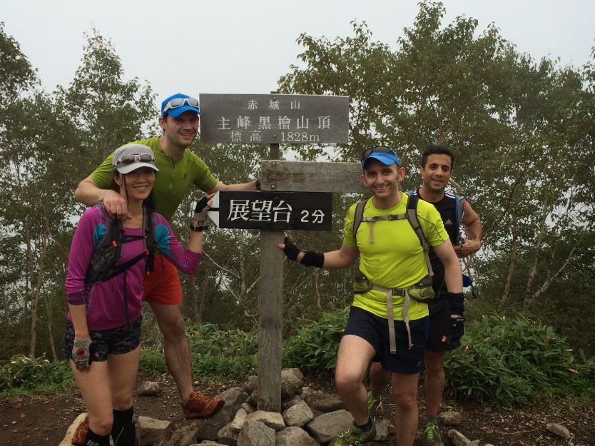
will soon reach a turn-off to the left, signposted for the 1828m summit of
Kurobi-san, the highpoint of Mt Akagi, just 5 minutes away. There is a good
viewpoint another 5 minutes beyond the summit, so if the weather is clear I
recommend taking this extra little detour.

From
the summit of Kurobi-san, retrace your steps to the junction, and this time
head left in the direction of Komagadake. A few minutes along the trail you’ll
come to a shrine.

Carry
on and the trail begins to descend in earnest down flights of wooden steps.
Some way below you’ll come to a flattening, with striking views back of what
you’ve just come down. From here the trail climbs again to the tree-covered
summit of Komagadake.


Continue
on down a mix of steps and trail, zigzagging all the way to the road and the Komagadaketozanguchi trailhead (駒ヶ岳登山口).
From here, all that remains is a short jog back to the Visitors Centre to
complete the circuit.
Overall:
A
very satisfying run around an ancient natural feature and hyakumeizan, with a total distance of about 17km and an overall
elevation gain and loss of about 1500m respectively, on a good mix of smooth
and technical trails.
No comments:
Post a Comment